Live UK Snow Radar
Live UK snow, sleet and winter precipitation radar imagery for monitoring wintry weather across the country.
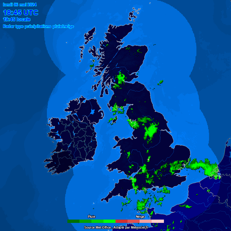
This page brings together live radar tools that can help show where snow, sleet, rain and mixed winter precipitation may be occurring. It is intended as a quick visual guide for checking developing winter showers, frontal snow, sleet bands and areas of precipitation moving across the UK.
Live UK precipitation radar
How to use the snow radar
The radar display can be used to follow areas of precipitation as they move across the UK. During cold weather, precipitation shown on radar may fall as rain, sleet or snow depending on the air temperature, ground temperature, elevation and local conditions. Snow is most likely where colder air is already in place, especially over higher ground or during heavier showers where evaporative cooling can lower temperatures near the surface.
- Use the animated radar to see the direction and speed of incoming precipitation.
- Compare the radar with local temperature, dew point and weather warnings before assuming precipitation will fall as snow.
- Remember that radar shows precipitation aloft and may not always match exactly what reaches the ground.
UK snow and sleet radar image
About this UK snow radar page
LavenderCAM provides weather and environment information with a local focus on Leatherhead and the surrounding area, while also linking to wider UK weather tools where they are useful. This snow radar page is designed for winter weather monitoring and is best used alongside the LavenderCAM weather page, weather warnings page and live rain radar page.
For travel decisions, school closures or severe weather planning, always check official forecasts and warnings as well as local observations. Radar imagery is useful for tracking current precipitation, but it is not a guarantee of road conditions or snowfall accumulation at a specific location.
Note: live radar sources can occasionally be delayed, unavailable or blocked by browser privacy settings. If the embedded map does not load, try refreshing the page or opening the radar image directly.
Snow radar frequently asked questions
Does radar always show snow at ground level?
No. Radar shows precipitation detected above the ground. Whether that precipitation reaches the surface as snow, sleet or rain depends on the temperature profile of the atmosphere and local surface conditions.
Why does the radar show precipitation when nothing is falling?
Sometimes precipitation evaporates before reaching the ground, particularly in dry air. Radar can also occasionally show clutter or weak echoes that do not produce meaningful weather at the surface.
Is this page only for Leatherhead?
No. The page is useful for checking snow and winter precipitation across the UK, but it is included on LavenderCAM because winter weather tracking is particularly useful for Surrey, London and South East England.